Collected are several samples of the maps I have made during my time as a Geography major at the University of Kentucky, stemming from classes, internships, and other experiences.
GEO 405 (Advanced Cartography)
A digitally hand-drawn map merging real-life bare earth data with the fictional environment of the Legend of Sleepy Hollow.
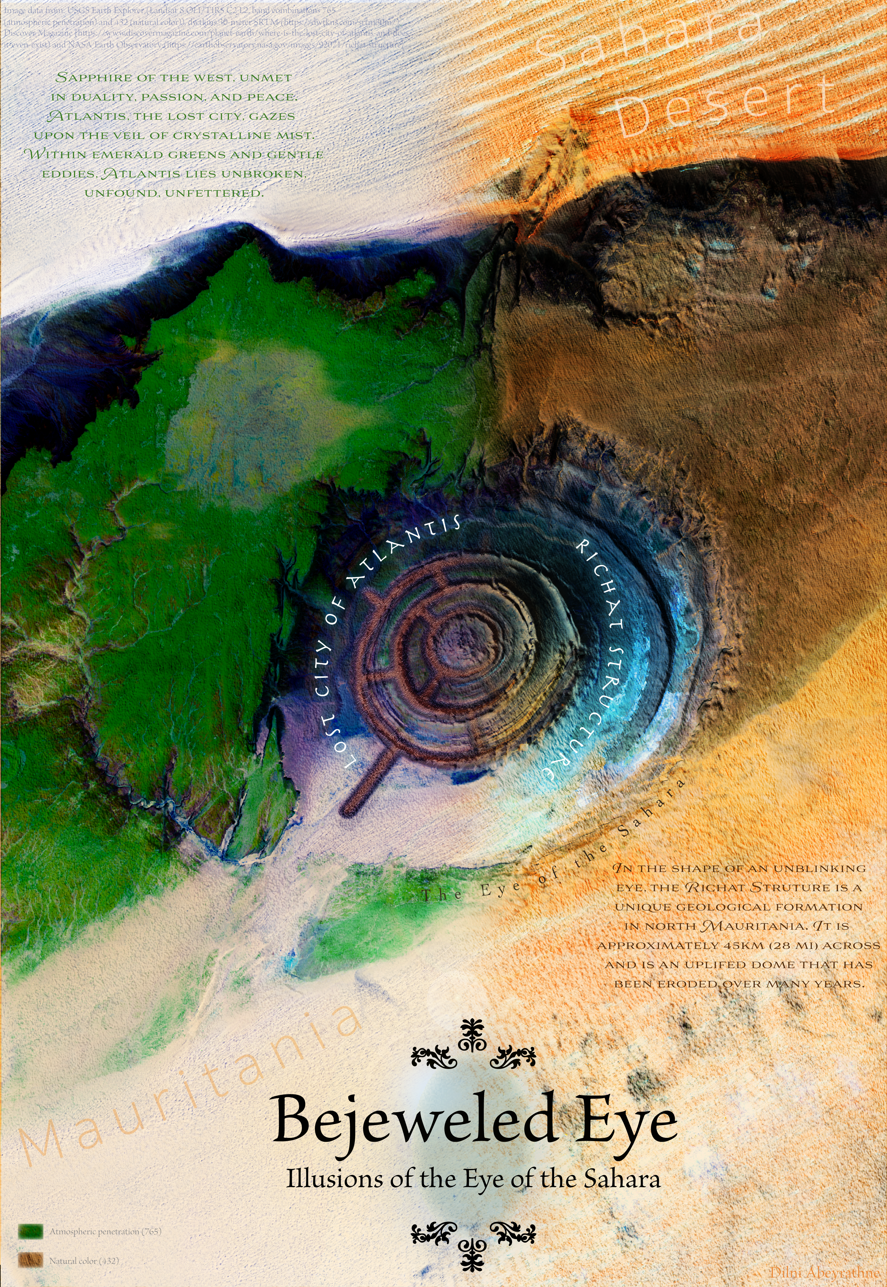
A merged satellite imagery map illustrating the Eye of the Sahara (Richat Structure) and the environment of Atlantis, which has been speculated to have been built on the eye (a conspiracy). The left side uses stylized atmospheric penetration imagery and the right side uses stylized natural color imagery.
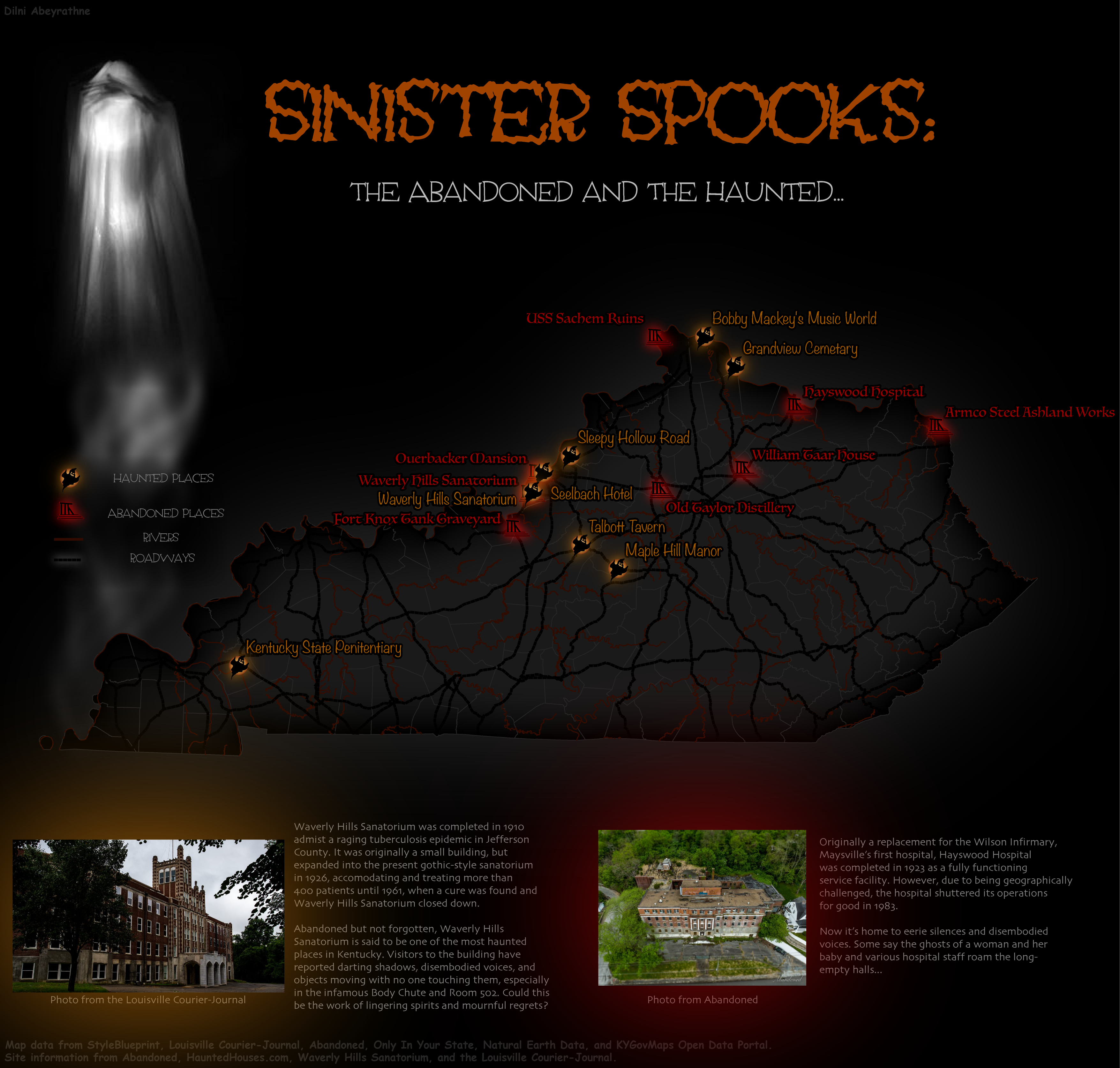
A Halloween-themed map visualizing popular haunted and abandoned locations in Kentucky.
GEO 409 (Advanced GIS)
A map of a stylized LiDAR point cloud visualizing Cumberland Falls.
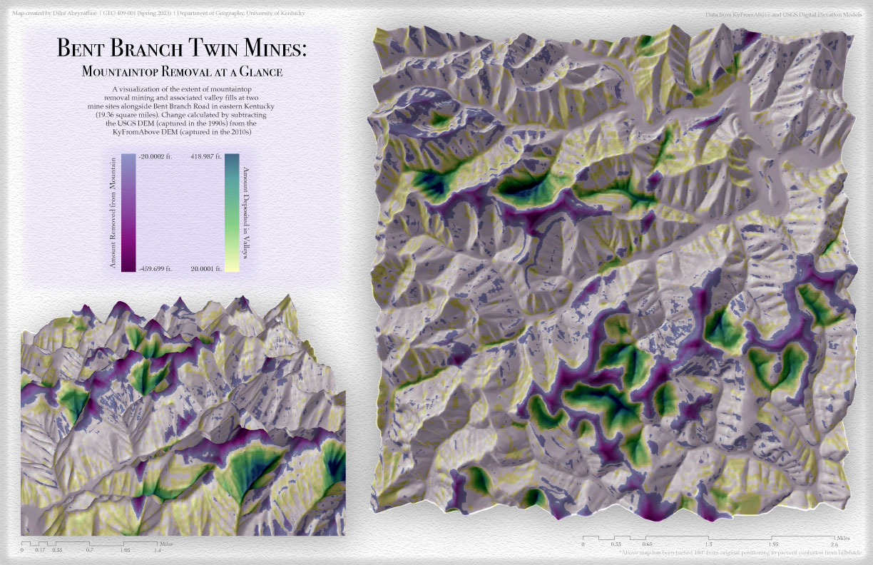
A map depicting mass terrain modification of two mountaintop removal mines on either side of Bent Branch Road in Pikeville, Kentucky.
A map showcasing various types of landcover in the state of Kentucky.
GEO 509 (Workshop in Geospatial Technologies)
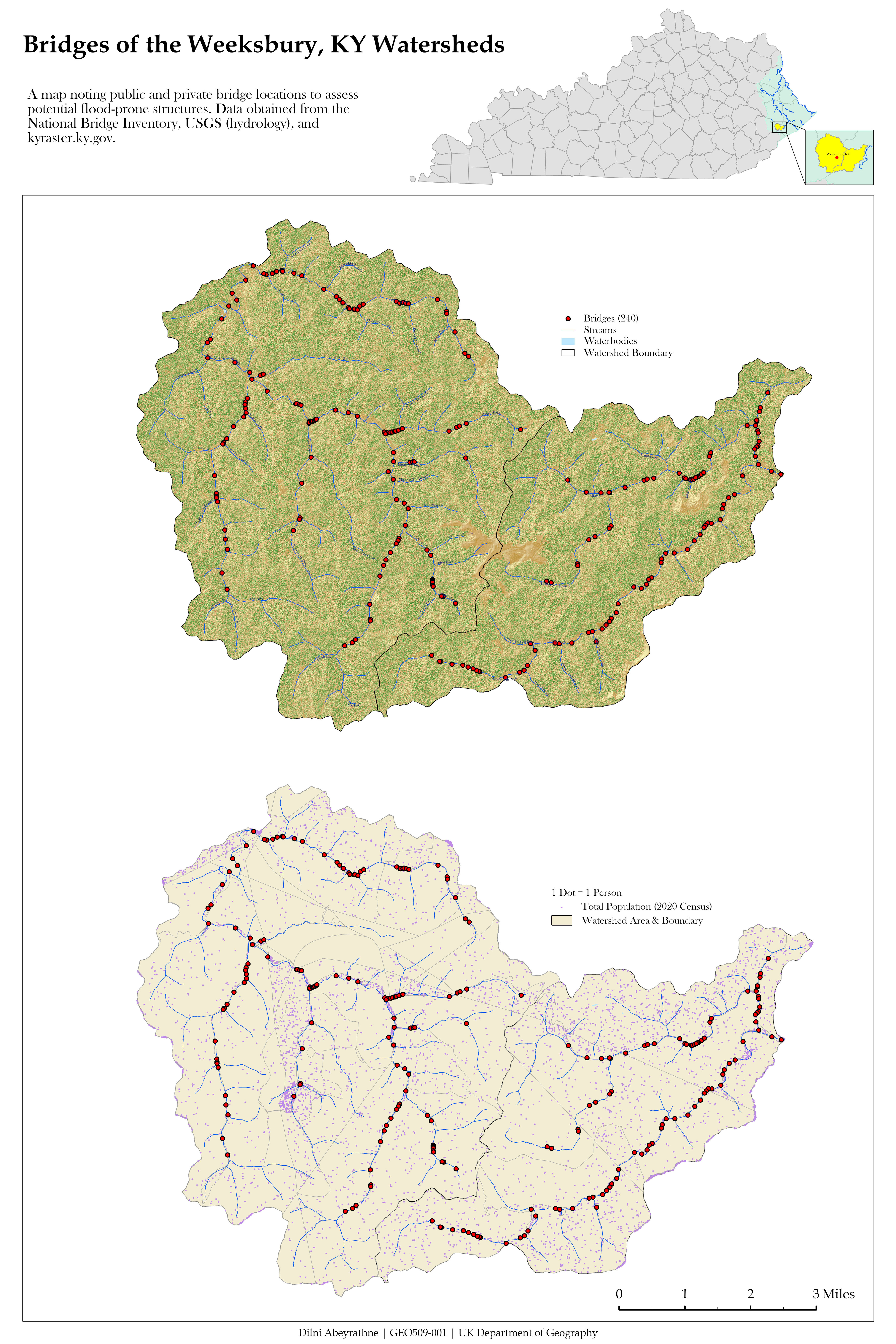
Two maps illustrating noted bridges and population density of the Weeksbury, Kentucky watersheds.
A map visualizing three particular bridges within the Weeksbury, Kentucky watershed study area.
GEO 305 (Elements of Cartography)
A map exploring levels of light pollution and noted connectivity to the natural environment in the United States.
A shaded relief map depicting tree canopy coverage and populated areas in India.
GEO 309 (Introduction to GIS)
Comparative maps visualizing documented tornadoes of 1950 and 2019 and associated property damages.
Mapping Project Commissions
A redesigned map for Dr. Nari Senanayake depicting hotspots of chronic kidney disease of unknown etiology (CKDu) in comparison to agroecological zones in Sri Lanka.
A map made for Dr. Lydia Pelot-Hobbs illustrating carceral and freedom sites in New Orleans.
One version of a map made for Dr. Wendy Cheng illustrating incidents of campus spying in U.S. universities.
Kentucky Geological Survey's Paul Edwin Potter Internship
Final research poster depicted the set of bare earth maps and derivative maps created for exploring landslides in mountaintop removal mine sites in eastern Kentucky.
Mapshop
A map analyzing differences in census tract boundaries in the 2010 and 2020 censuses for Kentucky.
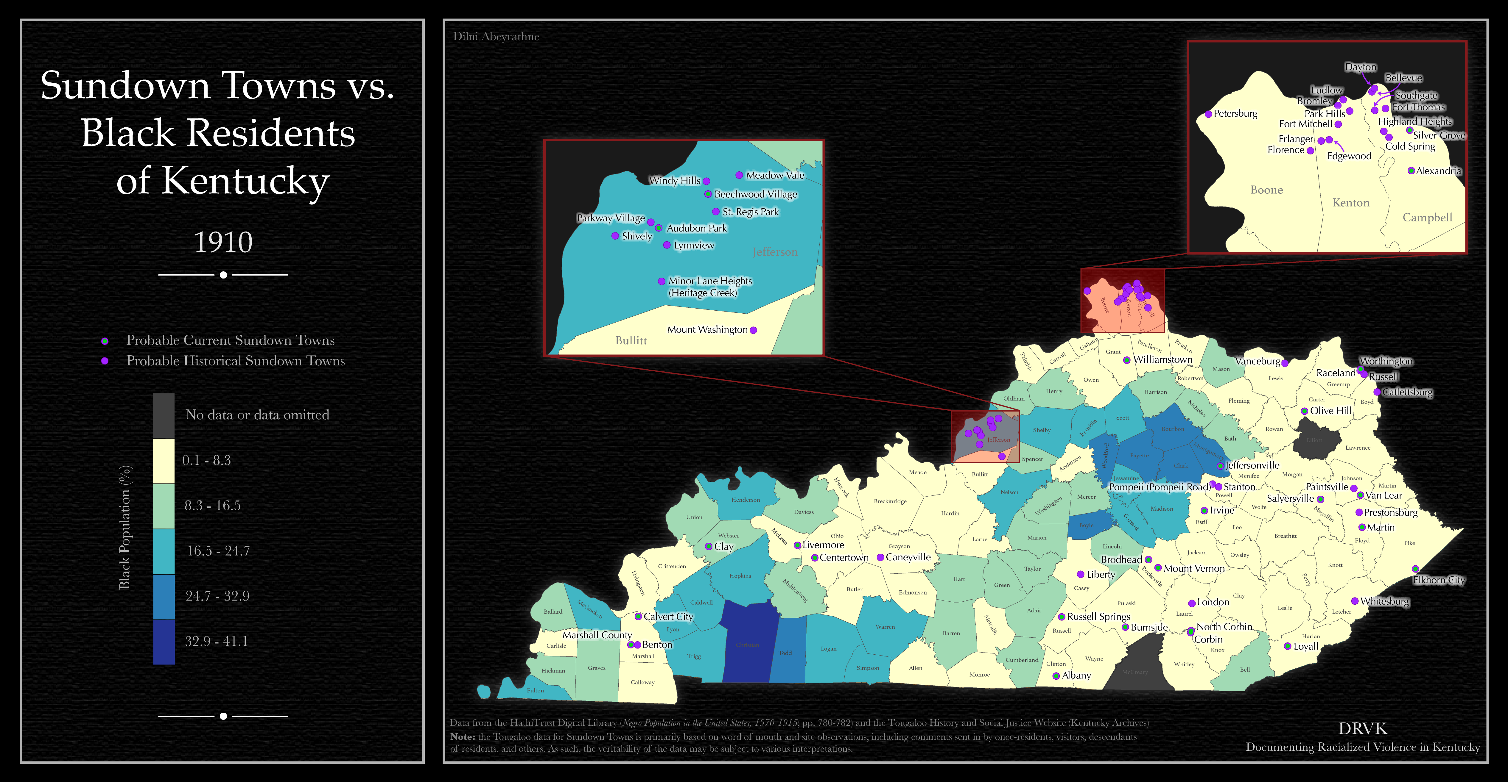
Documenting Racial Violence in Kentucky (DRVK) project
A stylized map illustrating documented lynchings across Kentucky from 1877 to 1969.
A map comparing the locations of sundown towns to the recorded black population in 1910 in Kentucky.
An animated set of maps depicting demographic data for black residents in Kentucky from 1880 to 2020.
An animated set of maps depicting recorded lynchings in Kentucky from 1977 to 1969.