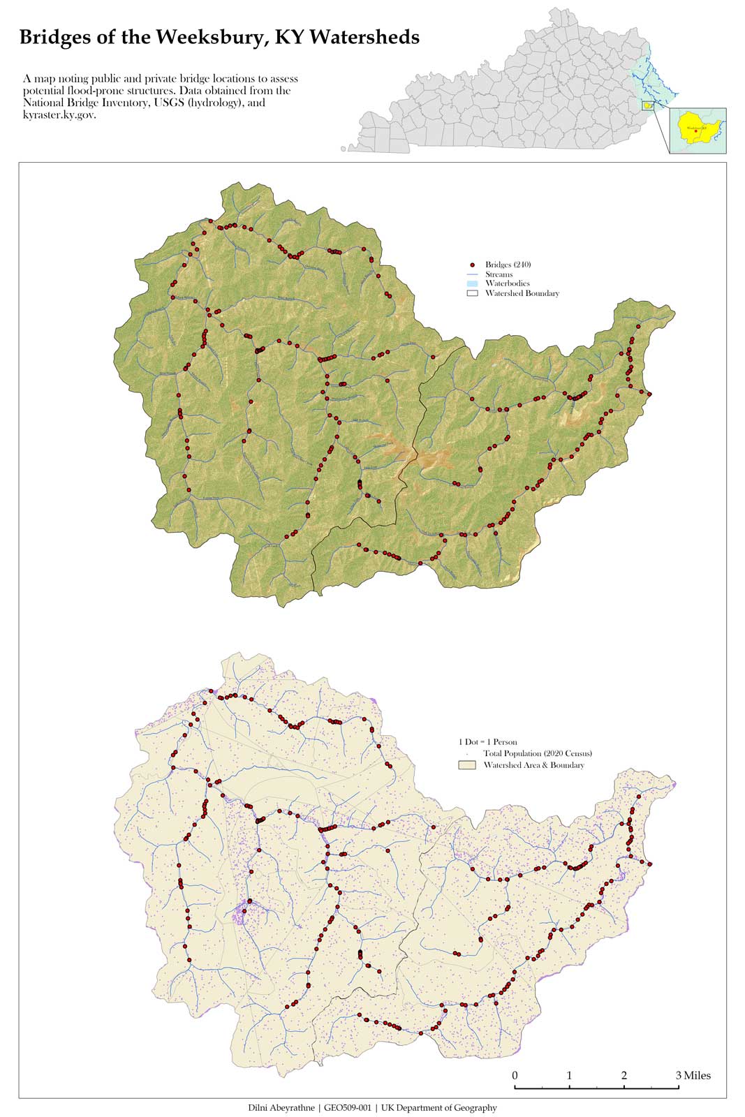
Weeksbury, KY, a small, unincorporated community and coal town in Eastern Kentucky, was chosen for this project segment. Two watersheds encompassing it were selected for mapping terrain, digitizing bridges, and visualizing population.
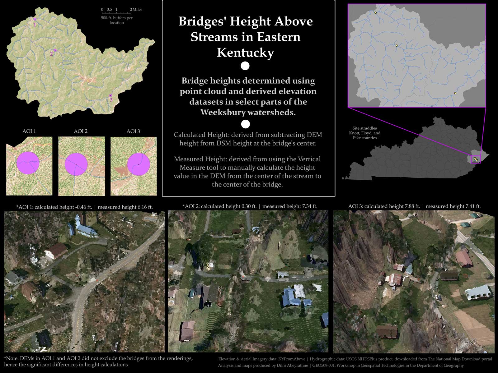
From the 240 bridges mapped, three were closen for close analysis. Using point cloud (LiDAR) and derived elevation data, the heights of these bridges were automatically calculated and compared against a manual measurement done through ArcGIS's Vertical Measurement Tool.
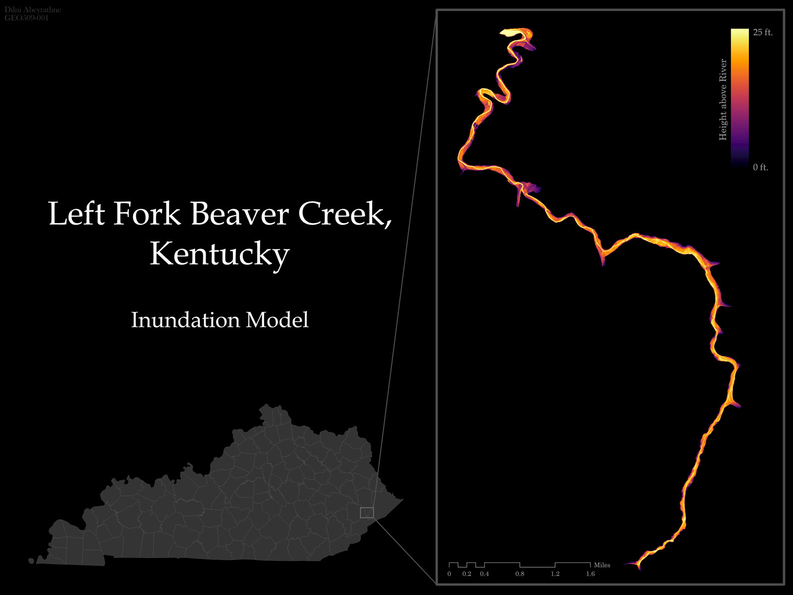
An inundation model was created to model potential flooding in Left Fork Beaver Creek, with the maximum rising water level set to 25 feet. The model was superimposed onto a DSM (digital surface model) layer, allowing trees and structures above the maximum flooding height to be shown.
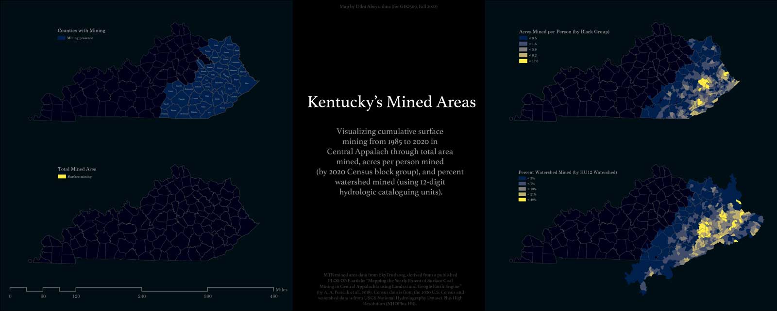
Comparative maps visualizing cumulative mining activity were created with an emphasis on total mined area and location, total mined area per person (by block group), and total percent of the HU12 watershed units mined.
 High resolution version
 High resolution version
 High resolution version
 High resolution version